I decided to take a brief break from wrapping up the Plat Tectonics simulator work to actually play with it and see about using the generated elevation data in other programs.
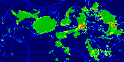 |
Graphical output from Plate Tectonics simulator.
Single-precision floating-point data is actually used for interchange. |
First off, I modified my C# port of Amit Patel's polygon map generator to support imported elevation data. There's still some incomplete features in this program, especially with my "Tolkien-esque" rendering mode. When using imported elevation data, sometimes the river networks have anomalies, caused by low spots - "dips" or "holes" - within continental interiors. This could be addressed either within the Plate Tectonics simulator or within the map program.
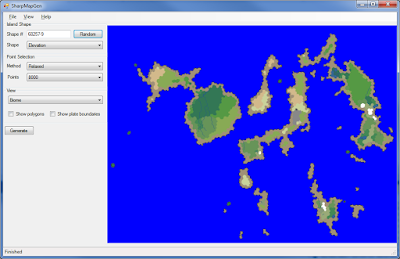 |
Elevation data from Plate Tectonics simulator was the data source for
this image in a polygonal map generator. |
 |
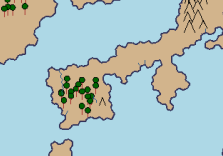
| Close-up of the northwestern continent, in Biome view. |
 |
| Close-up of part of the map, in "Tolkien" view |
I've also implemented an import mode for the planet generator I've mentioned in posts past. For terrestrial planets, it usually uses 3D Perlin noise to create the elevation map of the world. With the import, it uses the imported elevation data instead of the noise.
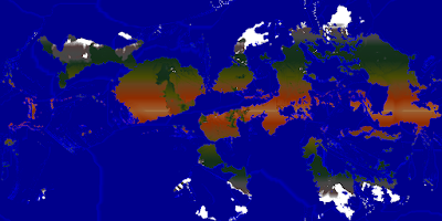 |
| Map created from importing the elevation data into Planets program |
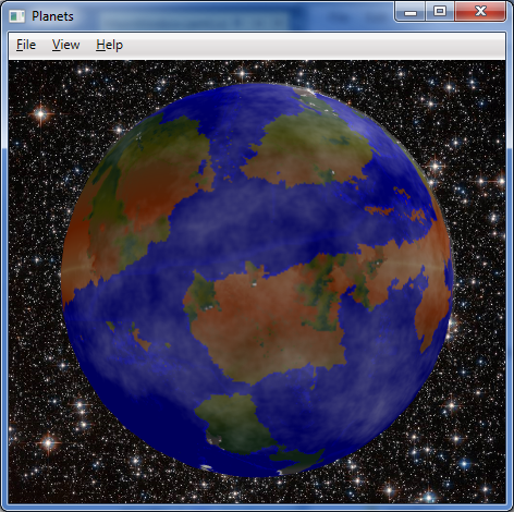 |
| The map wrapped around a globe, with some fractal clouds partially shrouding the planet. |


No comments:
Post a Comment