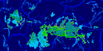
It is well after midnight. My first approach at getting the erosion situation ("caterpillars" vs. worn-down mountains) resolved did not work nearly so well as I had hoped. Careful tuning was not enough. Either it was ineffective or it eroded land down to shoals.
 |
| Not cutting it |
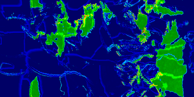
So I decided upon a new approach. The erosion algorithm has been split into two. One is the "wave erosion" for coastal and island erosion. That's my very crude but rather effective method. The other part is the rain drop algorithm implemented by the original PlaTec developer, Lauri Viitanen. Wave erosion runs more frequently than the regular erosion. This is a fairly effective approach, although different parameters can yield different results.
 |
| Decent mountains, island chains, few "caterpillars" |
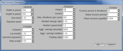
I'm still not quite happy with this outcome. Some of the simulation parameters are still hard-coded constants. I have another few hours to go integrating all the parameters shown in the GUI as true parameters that can be passed into the main simulation class. The restart and aggregation overlap settings can really improve the compactness of the continental masses that form. Likewise, having the fractal parameters driven from the UI (or later, a settings file) will be quite nice - as it is, I currently have to make changes to hard coded constants. Ugh.
 |
| Parameters organized |
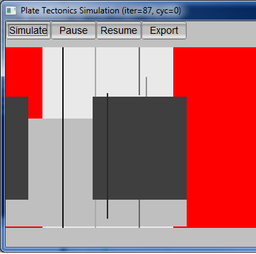
I was testing non-power-of-two dimensions for the map and discovered a problems. I can use whatever aspect ratio I want, but if any dimension is not an exact power of two (two raised to an integral positive power), problems ensue. I am currently debugging this, which yielded the colorful image below. Each of the grayscale rectangles represents the bounding box of a plate, while the red represents areas that plates have moved away from. Those lines? They represent an indicator that I have problems. So, either a bit more work, or forget about non-power-of-two dimensions for now.
 |
| Seeing red |


No comments:
Post a Comment