It is all over but the cleanup. The algorithms are all working about as I'd like. I understand the erosion algorithms a lot more now. The original version of PlaTec from several years ago used a modified image smoothing algorithm for erosion. The 2015 version incorporated, in sequence, a hydraulic erosion model (rain drop method), the adding of some random noise to the elevation, and then a super-simplified but effective approximation of thermal erosion. Run it too frequently, and the continent would erode away to sea level, but often in the interior before along the coasts.
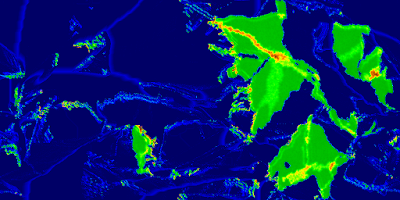 |
| Example 1 |
Because of some of the abnormalities (the "caterpillars" and eroded mountains) and that tendency, I added a coastal erosion process that lessens the elevation of cells adjacent to water, and run the main erosion algorithm less frequently. I also increased the threshold for the main erosion algorithm, reducing over-erosion of the continental land masses.
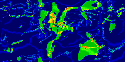 |
| Example 2 |
About my only complaint is the high degree of variability in the "quality" of the results for a given set of parameters (other than the random number generator seed). The majority of results are acceptable, but some oddities can show up, and you never know if you'll get them or not. So this isn't greatly amenable to fully automated operation; a person should definitely review results for suitability.
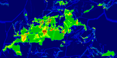 |
| Example 3 |
So what's left before release? Just the cleanup. I have a variety of debug outputs that need to removed. There are a handful of functions that should ideally be made members of classes if possible - in one case, I'm not sure its possible due to how FLTK callbacks work. I guess I'll find out. I drastically increased the number of simulation parameters that were exposed. However, the export code only currently writes out the few parameters that were originally exposed. So that will need to be updated. I suppose it could also use a quick document describing the simulation parameters and how to accomplish different basic goals with them can be accomplished. Then to GitHub with the lot of it.
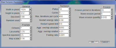 |
| Parameters - these should all be written to file when exporting image or elevation data |


No comments:
Post a Comment